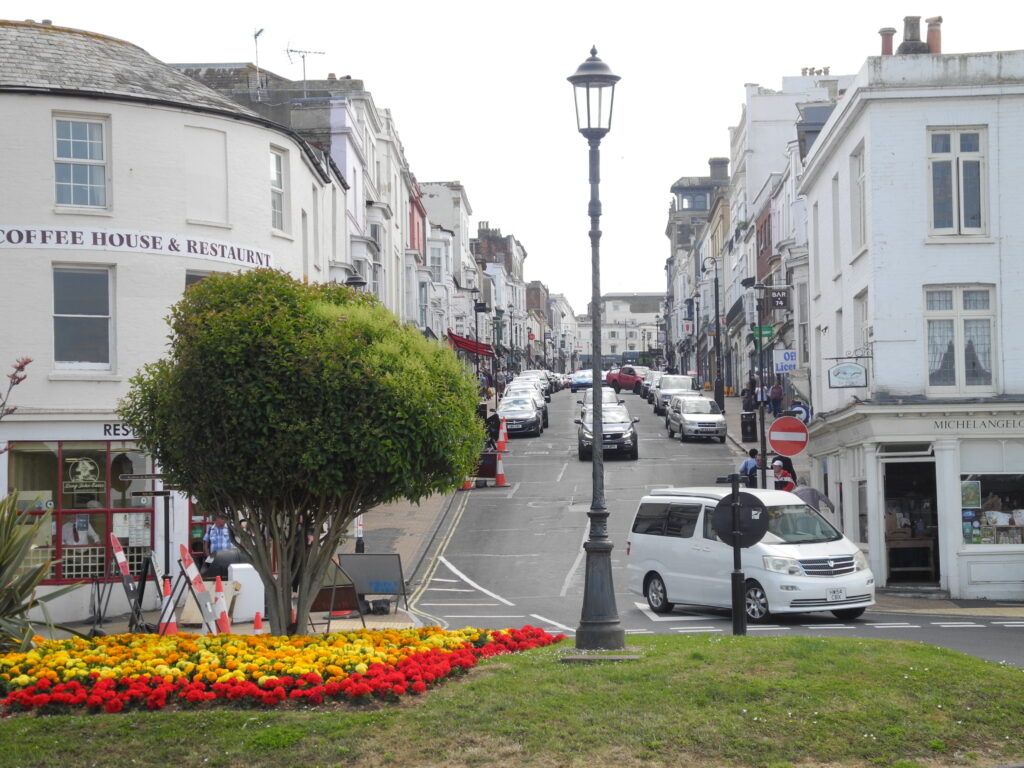
I have chosen Union Street in Ryde as my Road to look at. It is less than a mile from my home, and is probably one of the best known streets in Ryde, if not the whole Island. It gets closed for parades & carnivals, is the home of the international scooter rally in August, it has also been closed for the Ryde Slide; a very long waterslide running the length of the street,
It is a one way street, with vehicles heading down towards the sea, it has a variety of shops, restaurants and a Victorian arcade. I walk down the street most days as the globemakers workshop is on a parallel back road.
I initially had the idea of taking a photo from the same spot hourly for a 24 hour period. Whilst this could be an interesting project, the idea of staying up all night, doesn’t really appeal to me, I need my sleep!
This led me to thinking I could take day/night photos and photos from different spots on the street, or possibly photos 12 hours apart, perhaps 6am and 6pm, this would be more manageable than every hour. I may focus on shop fronts, or I may just look and see what I can find.
I did an initial reccy today and took a few from the bottom, walking up, and looking down. Note to self, don’t take teenage daughters on such a mission. There was much embarrassment, and telling me I looked like a tourist (obviously not a good thing in a holiday destination!)
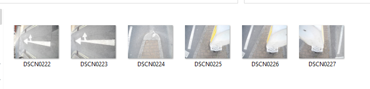
Union St. from the bottom, I took several photos and chose this one as I managed to get the lamp post roughly in the centre of the road.
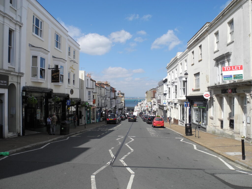
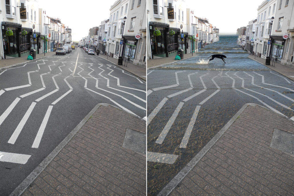
Union St from the pedestrian island at the top. I was trying to also capture the yachts in the Solent, but they are a fait way away so not much of a feature. I chose this photo as it had the clearest view of the road, without vehicles in immediate view. I think looking at this I will try to get a picture first thing in the morning, so I can try to get a better angle on the road markings without getting run over. I’m not sure if I’m being influenced by the lecture, but I can imagine the zigzags running down the road and turning into waves. This photo has made the decision for me that I will start by focusing on the road markings.
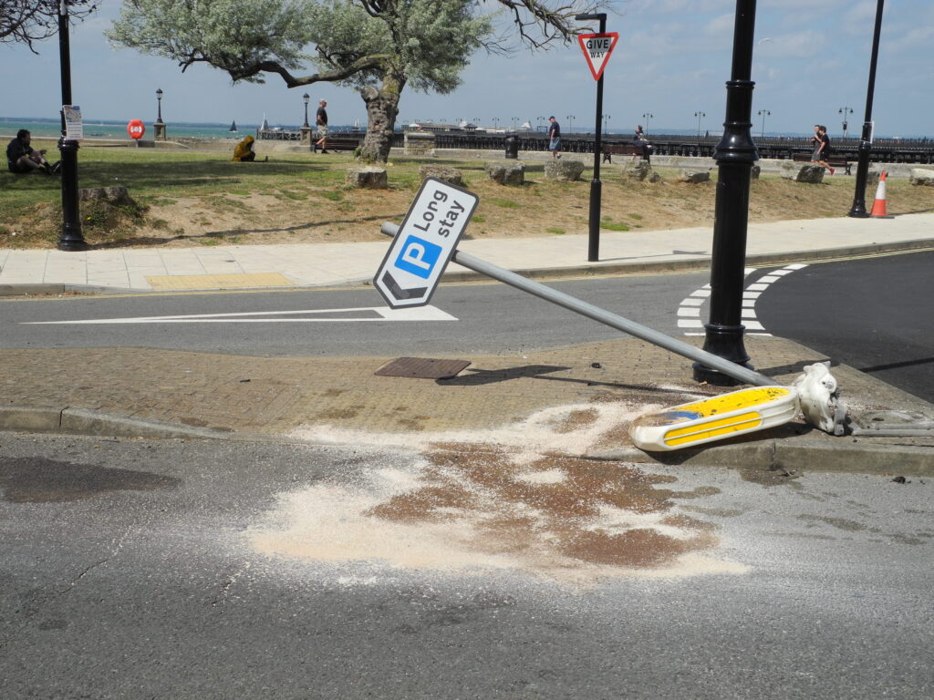
I found this crash scene quite interesting, I thought perhaps ‘blood’ when taking the picture and hoped somebody isn’t taking a ‘long stay’ in the ground, but now realise its probably oil.
I think sometimes you notice things in the photo that you wouldn’t necessarily see with your eye, a kind of stepping back to see more, a detachment from the real, because it is stationary there is no interference of traffic/movement/people/noise.
3pm Saturday
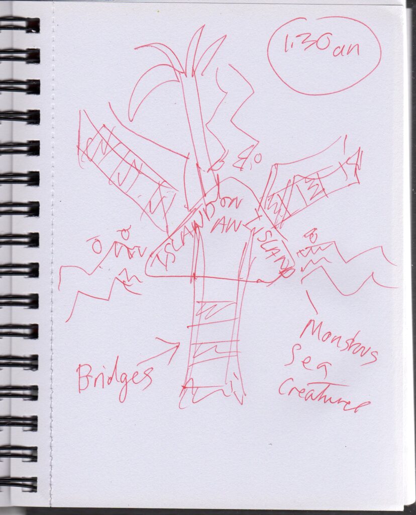
Over night I had the idea of an island on an island, the road markings perhaps becoming crocodiles or sea monsters, or waves on the ocean, a desert island. This prompted me to focus a bit on the Island at the top of the hill.
6am Monday
I like the textures of the worn out paint, it is reminiscent of lino cut and print. Also the cracks on the bottom of the yellow beacon. I have walked over this traffic island many times, but this is the first time I have noticed the stickers on the black box.
I am possibly thinking of a photo montage perhaps David Hockney inspired?
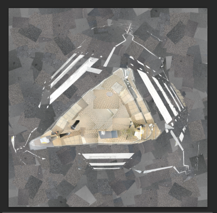
After fiddling about with the photos I have realised I do not have enough photos to make a satisfactory montage. Essentially I would like to make a montage of the traffic island and its surrounding road markings, and then make a some variations, both digitally and by hand.
Bit of a go at photo montage, still working on this one
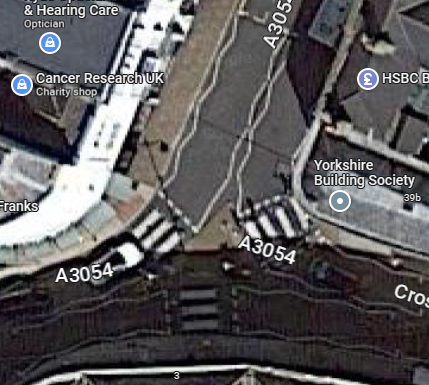
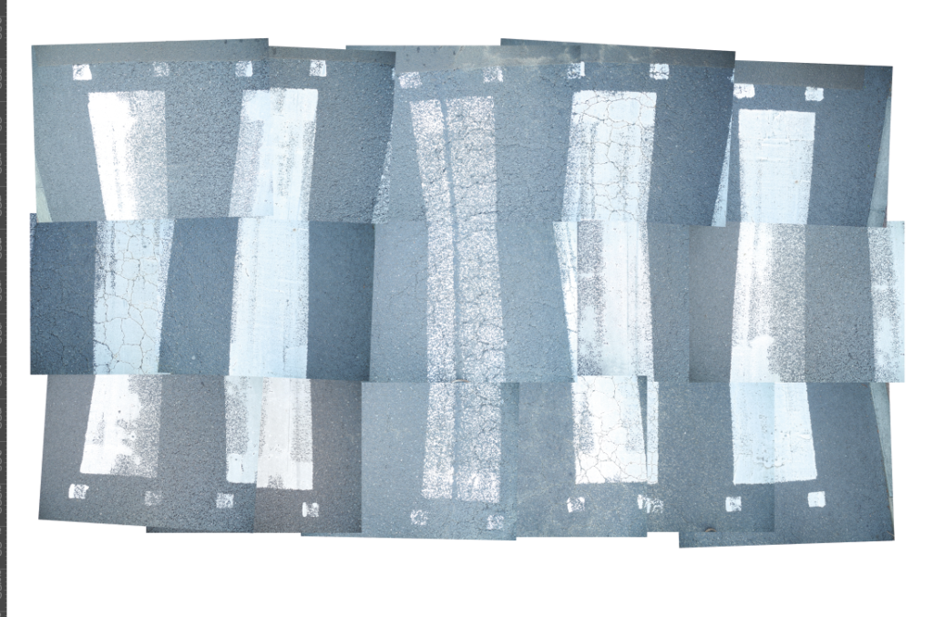
From google earth you can clearly see the road markings that interest me, with the traffic island in the middle
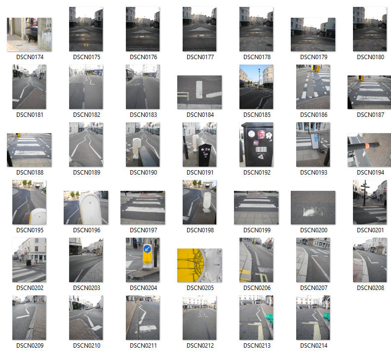
Monday evening photos, battery went on the camera, so not many. Got beeped by some irate driver, which made me laugh
Tuesday morning, on the way into work, what I wanted to capture the evening before. Hopefully now I have the whole island I can use it as a base and build up,
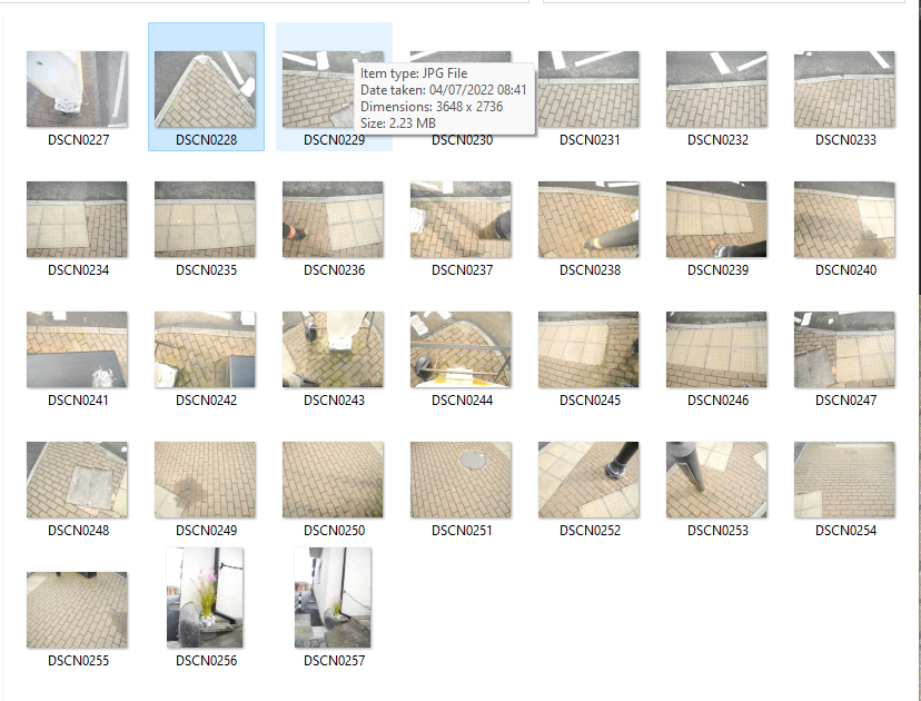
I’ve managed to form the island, a bit of a headache. Initially I opened all the photos at once, and then realised there was no way I’d be able to get them in any kind of order like that. So I shut them all and opened one at a time with a rough idea in my head where they should go, remembering the order I went round the Island. Most of the photos are from the morning, but there are a few from the evening, the evening photos look far less yellow.
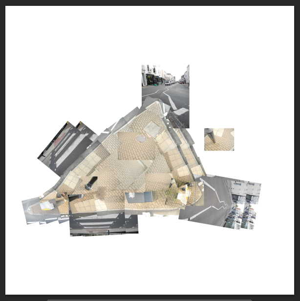
I could do with more photos with different angles of the road, which could prove difficult as I don’t fancy getting hit by a car! I may surround it with rectangles of the grey asphalt and add the road markings, and other bits later on
I am enjoying this process, it’s a bit like tying to do a puzzle and none of the bits quite fit, so slightly frustrating. It is different to my usual way of working which is usually drawing based.
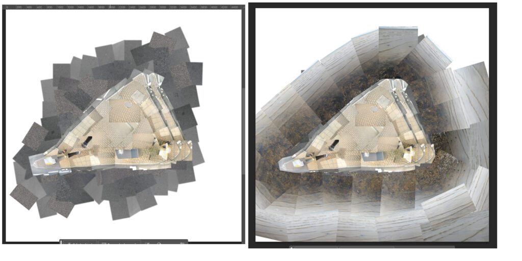
Patching the road around the island isn’t looking particularly satisfying, so I wen back to my idea of the sae round the island and took some photos of the shoreline, still within the radius of my home. I think the shoreline round the island is far better, and ties with my 1am vison of an island on an island. As the sky was grey, the sea photos turned out grey, not far off the tarmac colour of the road.
Although, seeing them next to each other I think there is room to use both
I NEED MORE PHOTOS
It is becoming increasingly frustrating trying to get the angle I need for my photos of the roads, the pedestrian crossings in particular. Although the below photo does make the island look as if it is on a pinnacle, bulging up towards us.
I’m not going to achieve what I’m aiming for in the time. The road is going to be closed this Saturday for a short time for the Mardi Gras procession, so I may see if I can sneak in between the cars stopping and the procession starting. Whilst I don’t want to start eating into next weeks time, I would like to come to a better place with this than I’ll be able to reach otherwise.
Or cheat a little? I spotted a very similar crossing on a not quite so busy bit of road whilst waking the dog, and decided to take photos top down of that crossing, besides my coastline photos weren’t in exactly the same spot either.
Cheats crossing;
The Solent’s best kept secrets | Hampshire and Isle of Wight Wildlife Trust (hiwwt.org.uk)
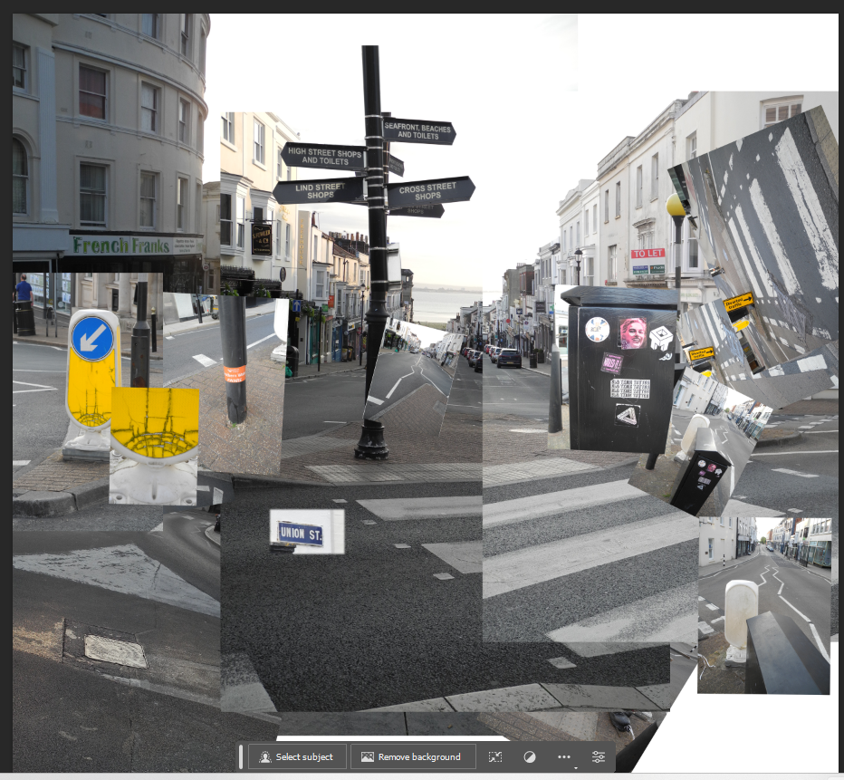
I have come to a reasonably ok place to stop, although I didn’t have time to print and work into these by hand. I tried throughout to use unmanipulated photos, the only manipulation being a bit of brightness/contrast and scale, I did cut, but would have cut out had I used traditional printed photos.
The first image is photo montage of the traffic island at the top of Union Street. The second image is the start of my imagination, including the round the Island yacht race which was on when I did my initial reccy photos a week ago.
I tried to be a bit more playful with the coast island image, adding a few illustrations in my usual kind of style, and words on the sign in local dialect, Overner (recently moved here from the North Island), Nammet (food, nibbles), Nipper ( young person), Grockle (tourist) . I would like to have had time to add more illustrations of Solent wildlife to my second image, it is yet another thing that is unseen but all around us on the Isle of Wight.
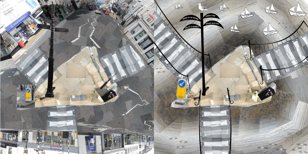
I could have continued and continued with this weeks task, I would have liked to have had more time to spend on the road markings, and also taken a greater look at street signs and furniture (bollards etc).
Lecture and stuff, just a few;
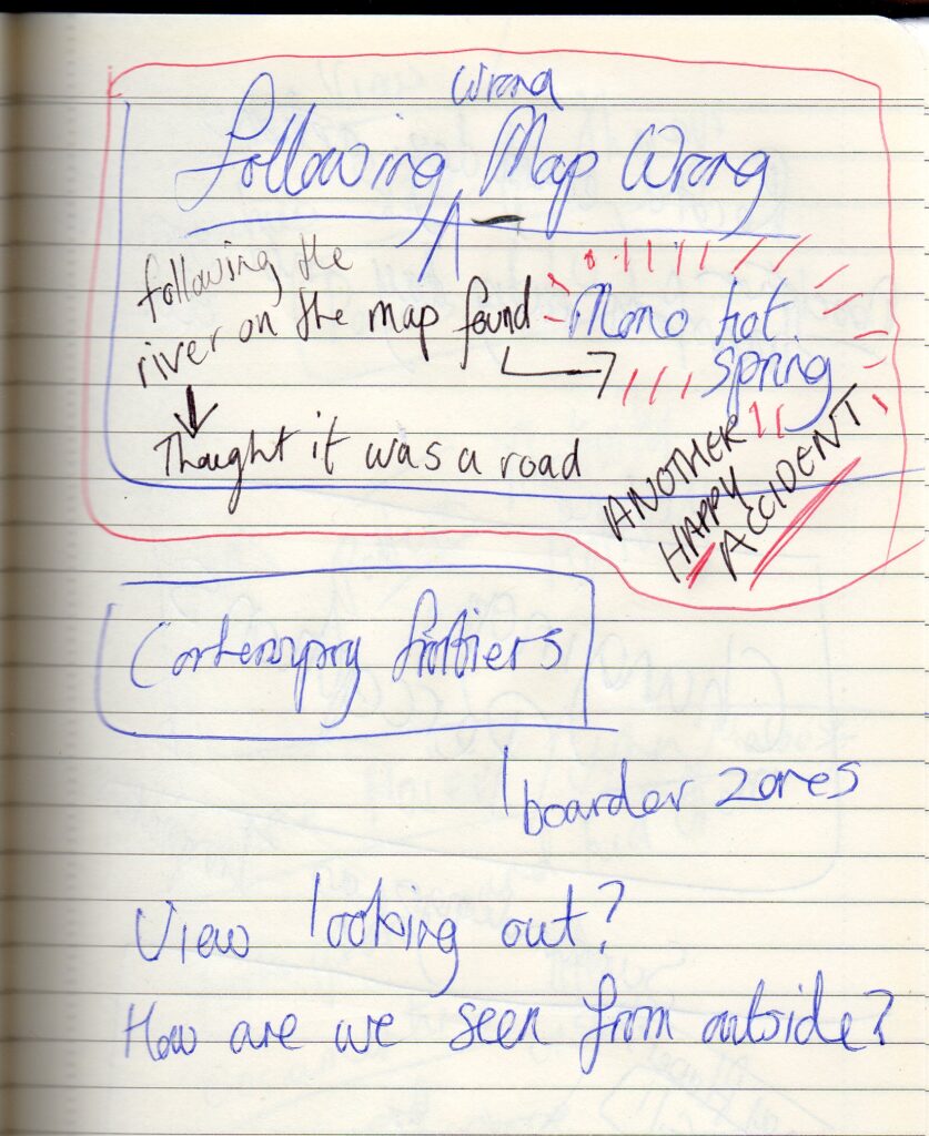
The tearing up maps and following a different map to the city, the Situationists, reminded me of a visit to California some years back, before satnav was much of a thing, In the mountains following what I thought was a road on the map on a single track road on the side of a mountain. The ‘road’ actually turned out to be a river (don’t ask me to map read, that’s ironic!). We stubbled across the Mono hot springs, a deserted Victoria era spar, would never have found it if I’d been following the road.
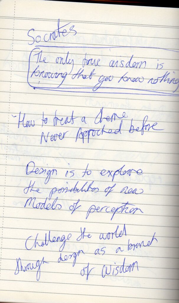
Socrates; love this
Record every day actions, transform the every day into something else.