13 January 2024
Going crazy waiting to start the next module, driving my family crazy in the process
So I shall start researching my idea from reading the breif, it may change, but I think I have fairly good responce;
During the Christmas holidays my husband emersed himself in maps of Ryde, looking at how the area has changed over the years through maps. How our house, now in a built up area was one of the first in the area. I have hijacked this as the start of my response to the Histories and Futures brief.
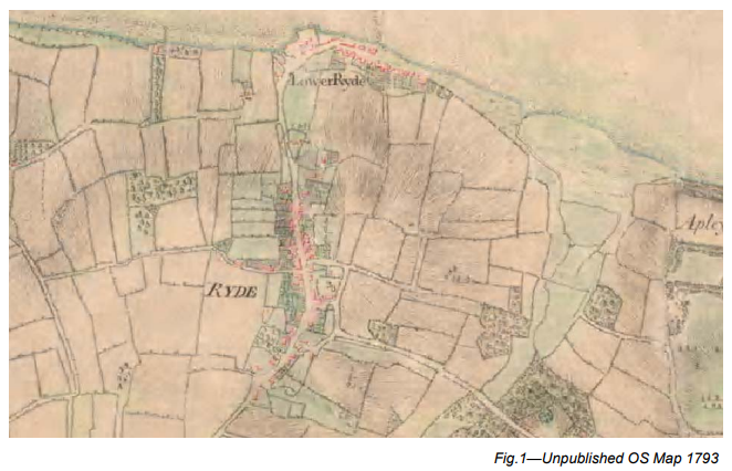
At the moment I am thinking I shall either start with a geological map of the area or the earliest map I can find of Ryde, and build on it map by map as time goes by, to the present day and beyond with local planning applications that have not yet been built, and future projections of development. Into this evolving map I want to incorporate impact on the natural world/flora/fauna/floods etc. I am also thinking about including decline of the natural environment with the rise of human activity. I am thinking of building on the ‘noticing the ignored’ brief from module one, where I added my own illustrations and changed the traffic island to an island surrounded by the sea, with perhaps movements in these added illustrations.
The maps could make a rather nice printed edition, but as the brief states that it is for an online publication I am thinking it could possibly also be used by the Ryde Heritage museum, as a projection/display.
Volume 30 for 1973.pdf (hantsfieldclub.org.uk)
Microsoft Word – Ryde Conservation Area Appraisal – Adopted April 2011.doc (iow.gov.uk)
During my feedback tutorial from the previous module with Frauke, I stated to ask about this possible mapping project. Some questions/ideas that have arriven from the conversation;
Plagiarism, is it ok to use the same source for information/research if the outcome is different? Ryde has a small museum of local history with well informed historians, which I would like to access again.
Plagiarism: I won’t build on the noticing the ignored brief, as Frauke pointed out I can not plagiarise myself.
We talked about an app for a phone, which is a possibility that could link with my idea of projecting the maps in the museum. I find the phone a strange phenomenon, so small in your hand but with vast possibilities. People do totally immerse themselves in these devices. I found the book in the resources already provided a really interesting concept, with holes cut out but an readable book, a kind of adult version of The Very Hungry Caterpillar by Eric Carle, layers changing the story as you turn the page.
My first idea was to map human population growth and the detriment of the natural world over the time of my maps. To avoid jumping on the bandwagon of environmental issues, which I care about greatly, I have been thinking what could be the purpose of my ideas.
Linking my maps with crime numbers referencing population size
Linking my maps with number of public houses, consumption of alcohol
Linking the maps with historical events, both on a local level and what was happening globally at the time each map was printed.
Looking at the history of cartography through to digital mapping, with a focus on Maps of Ryde
Finding a unique angle-related to Ryde, what makes Ryde Unique. At the moment I have; The Hovercraft, not really something I want to work with in the context of maps, but could take a different angle ditch the maps and look at Hover history, and where it is going in the future.
Note, local artist Jayne Myles makes souvenirs repurposed from old/used Hovercraft skirts
A unique aspect to Ryde is that it is the town on the beach, facing North towards the mainland, Portsmouth the nearest city is clearly visible across the five mile stretch of water; Combining land maps with cross Solent shipping charts? A gebco scan of the seabed between Ryde and Portsmouth, upon first inspection not done by gebco, but there must be another body/institute that would map the
National Coastal Monitoring – Site Search
Isle of Wight Map (british-coast-maps.com)
Seabed mapping data – Access bathymetry from UKHO (admiralty.co.uk)
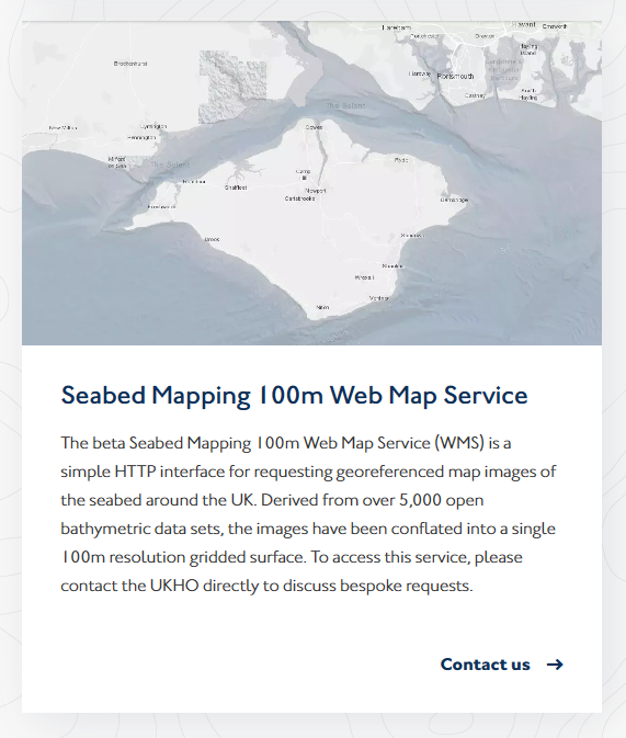
I will consider if I want to go down this route before contacting them for a map of the solent sea bed.
Also thinking about where online my final piece would go;
Visit Isle of Wight website
Visit Isle of Wight: Official travel guide to the Isle of Wight, UK
I am not particularly keen on tourists, which makes living in a tourist destination kind of daft, but there is a lot more here than tourism. Note, I’m also not very keen on many people who live here either, I’m sure this says a lot more about me than everyone else.
Ryde town council
Not sure about this one either, it could work. They are in the process of purchasing the NatWest bank building to create central offices and a ‘hub’. It is only about three doors down the road from their current offices, so possibly a waste of money- unless they decided to repurpose the current offices to housing
Front Page – The Museum of Ryde
And now week 1 has been released….
I am reconsidering my original mapping idea, should I save it for my final MA question? A tutorial to discuss would be handy
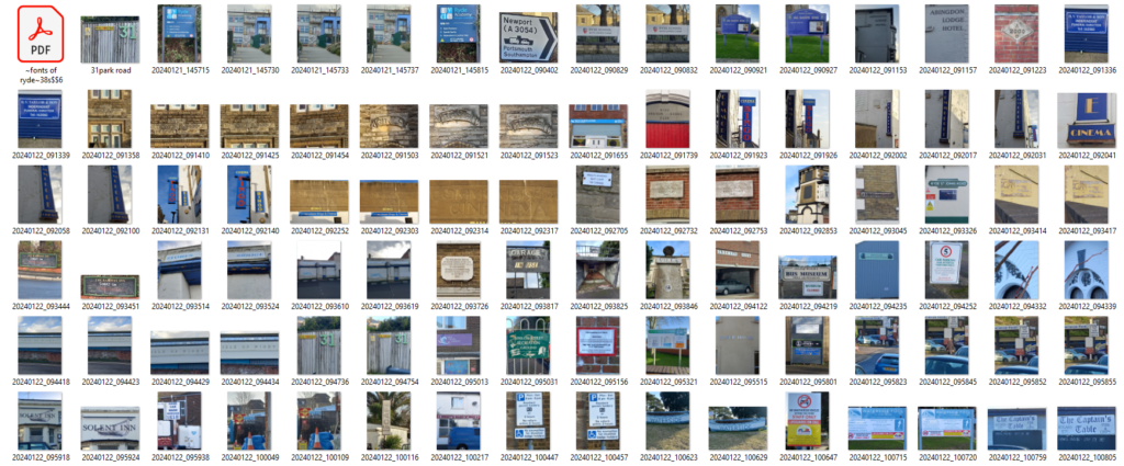
Much of the resources from this week is taking me back to the noticing the ignored brief, I am looking forward to going out with my camera, There are a few I have in mind to photograph before I start, and I will see what I can discover that I may not have seen before.
Workshop Challenge
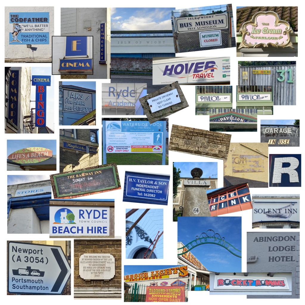
Photo’s taken whilst taking a walkabout.
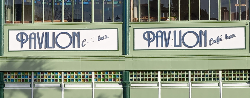
The pavilion bar. These 20’s style broken signs are either side of the entrance to the bar and bowling alley.
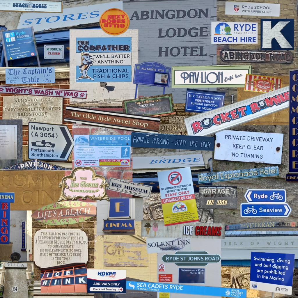
Ryde town is a mix mash of architectural style, with buildings dating back many years, (shown in the map above of old upper and lower Ryde as far back as 1793) It has been built up and built upon since then with a huge Victorian influence. This is reflected in the many fonts around the town, with not one uniform identity.
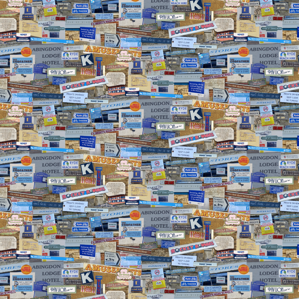
Upon laying out my many photos and struggling to get the looking coherent I have decided I need to loose all the white space in-between I had the thought of going out of the confines of the page, then of putting it in repeat and making a textile, I then thought perhaps finding every font reference to Ryde and making a print/repeat of that. Still thinking like a textile/surface designer 🤔
Talking of textiles…
I stumbled across this delight whilst listening to the radio, stunning tartan fabric found in a peat bog and beautifully recreated. The recreation looks so fine, I just want to pick it up and feel it in my hands.
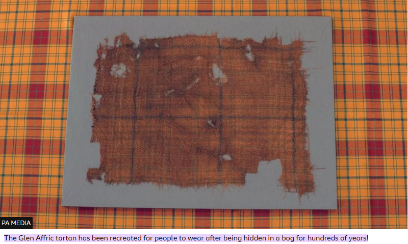
Scottish tartan: World’s oldest tartan brought ‘back to life’ – BBC Newsround
NewsletterApril2010_000.pdf (rshg.org.uk)
See the Dr Who boat – FreeWight
I have managed to choose four images that say Ryde. I’m sure the 5th will come to me like magic.
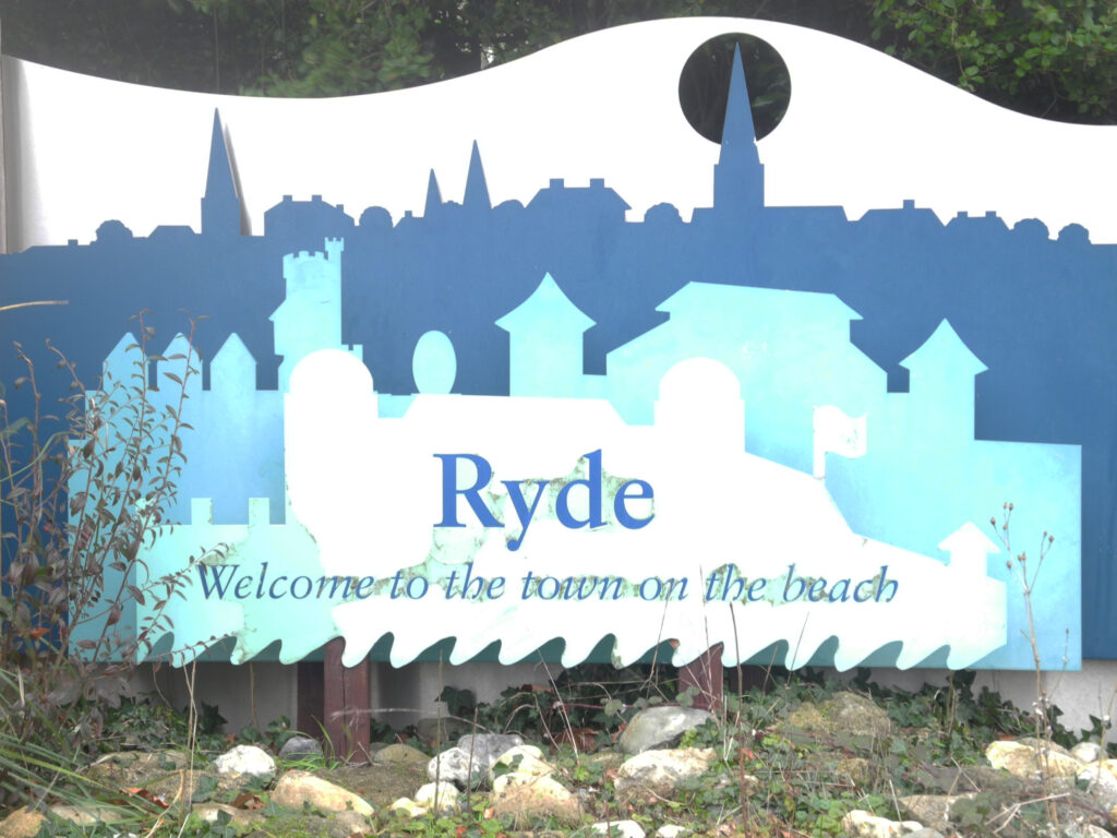
This sign is located at the edge of the town as you enter Ryde from the West. Both car ferry services are to the West, ‘Welcome to the town on the beach’ is a friendly sight; when I see this sign, I am home.
I have always liked this sign, and while the font itself may be no big thing, it keeps its serif on the name RYDE, so it is in keeping with the town’s historic architecture. What I love about this sign is the four coloured layered steel panels showing the silhouette of prominent landmarks of the town, and the waves on the beach.
(Note, I couldn’t find any background information on this sign, Brian from the local museum may be able to help me with this, I await a response). I also may struggle with a postcode, as it is roadside, but I’ll see what I can find.
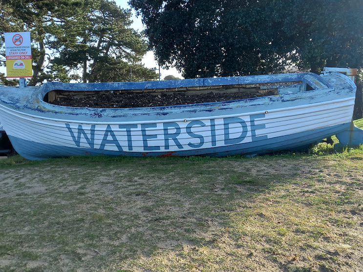
This old rowing boat filled with flowers and plants in summer resides near the waterside pool and the beach. The repurposed boat is hand painted with the word ‘Waterside’. The blue and white colouring is a common colour theme in Ryde. Perhaps to remind us the sea is near, should we forget we are on an island.
It is suggestive of the historic nature of Ryde, consisting of small fishing communities that dwelled here before the Isle of Wight became popularised by Queen Victoria. Ryde, the town on the beach, is very much situated on the waterside.
Note, this boat allegedly starred in the opening sequence of 1972 Dr Who series, The Sea Devils, Jon Pertwee apparently appears in this very vessel.
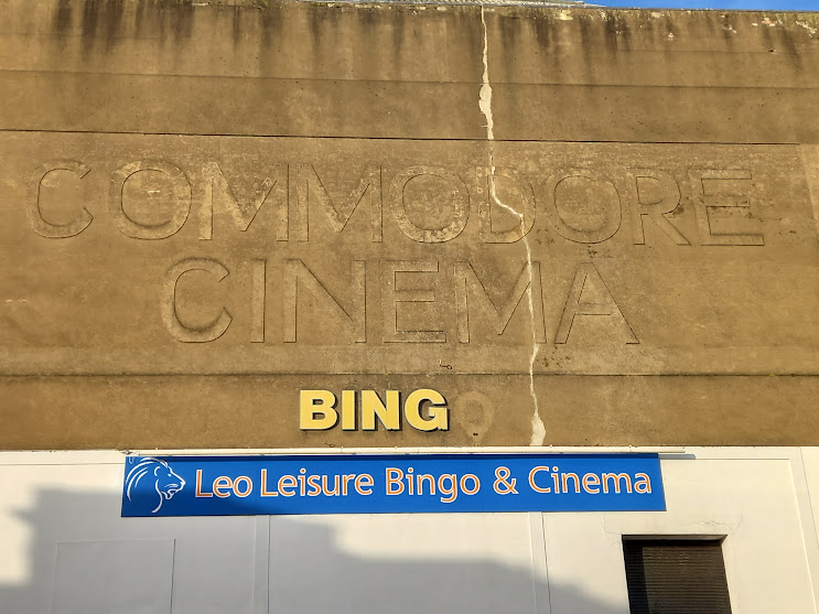
The Commodore Cinema and Bingo building is one of the most significant buildings in Ryde, situated at the top of the hill in the historic upper Ryde area. It can be seen from the ferry on the Solent and when walking up the pier.
Opened in 1936, the Commodore was used as a theatre as well as a cinema, and the cinema is still in use today; the embossed sign with its huge crack and missing ‘o’ from the word ‘bingo’ indicates a decline from its heyday, like the town itself. Without the modern Leo Leisure sign underneath, one would presume the building to be now derelict.
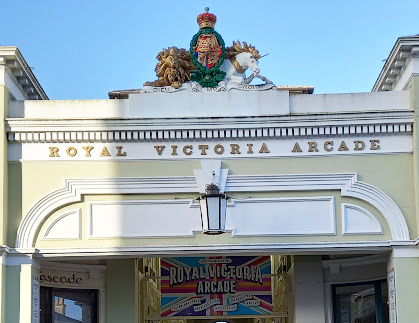
The Royal Victoria Arcade was founded by Willian Houghton Banks in 1835 and restored in 2011. Situated halfway down Union Street, the central street in Ryde, named after the Act of Union with Ireland in 1800, it unites upper and lower Ryde.
With its magnificent sculpted lion and unicorn overlooking the entrance and the gold-painted stone lettering, the arcade is quintessential Victorian England; the wealth and style of the time display its splendour. Much of Ryde is built upon this Victoriana, leaving a lasting legacy in the town.
I feel the new modern sign falls short here and adds little value to the arcade’s entrance.
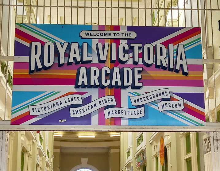
Above a close up of the new entrance sign.
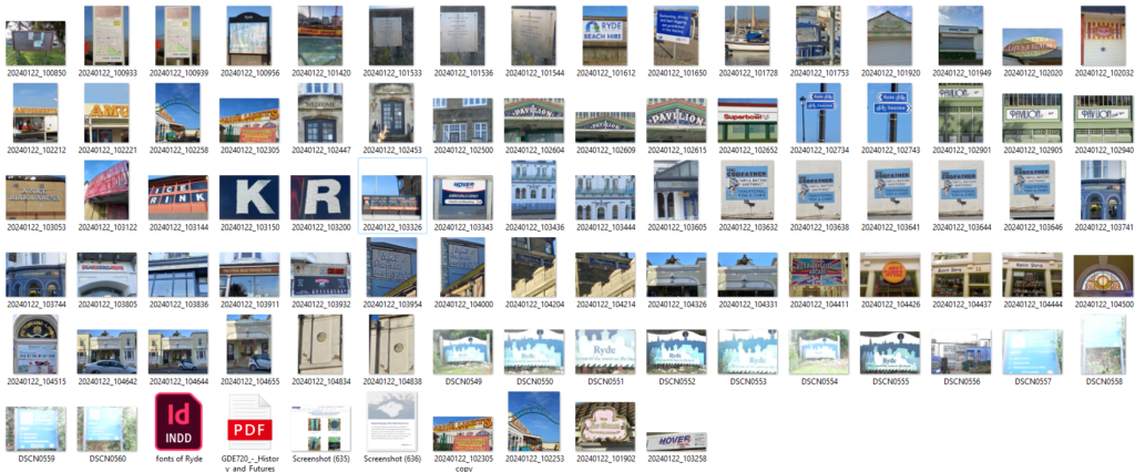
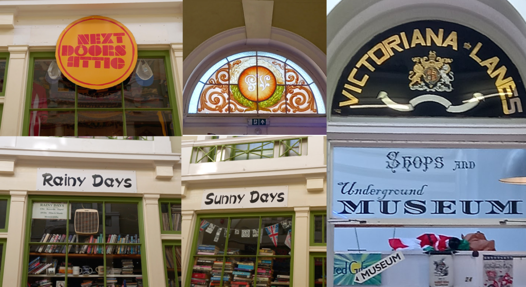
A glance at the eclectic shop fonts inside the arcade, there are more, this is a sample.
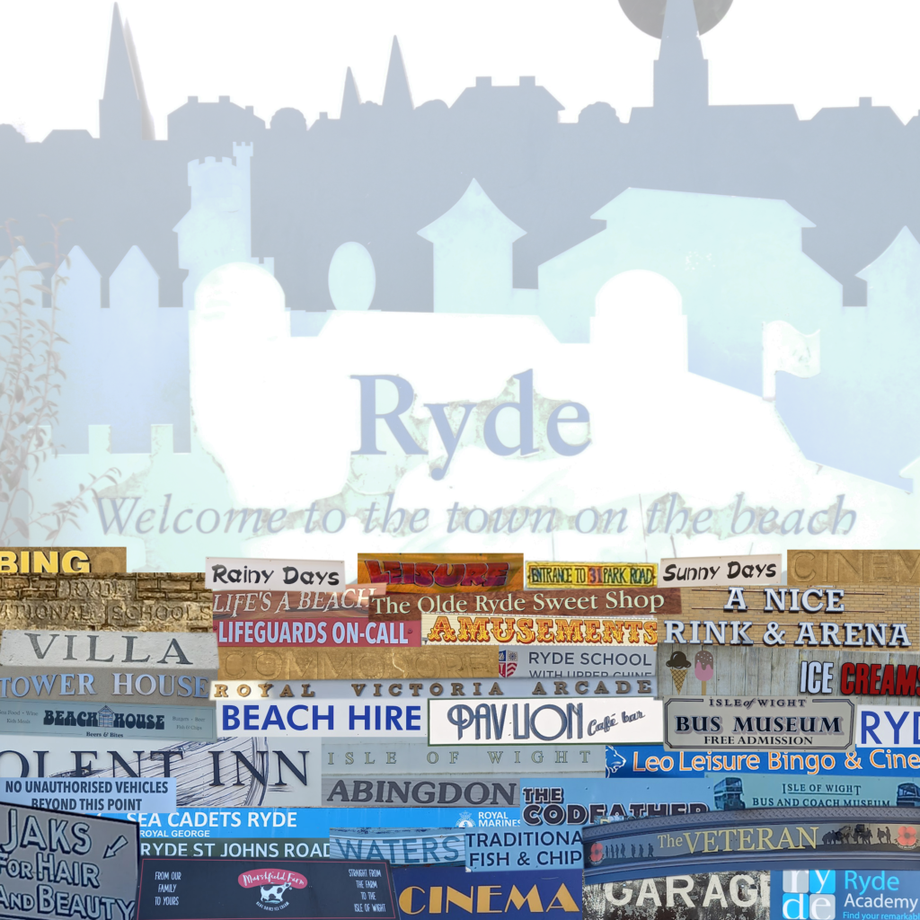
Some of the photos that weren’t selected I have collaged together like the mullti-layered history of architecture of Ryde. Some questions to keep the attention, and not overlook any of the fonts.
- Where can you get your dog washed?
- What can you have with your chips?
- Who created a building for the sick and needy, and when did they do it?
- Which museum is closed? (changed this to; what service does H.V Taylor and sons provide?)
- Name a mode of transport to get here?
- What unexpected thing can you hire?
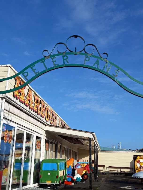
I just need to choose a 5th and final image now, and am probably going to go with this
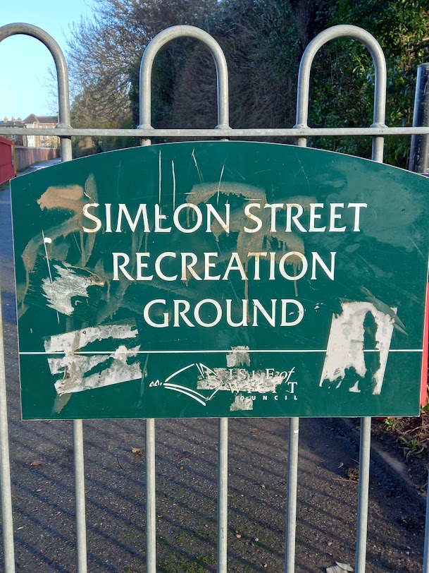
But have also been toying with this
I am more inclined to go with the top image. Justification, The isle of wight council signs will only be seen on the isle of wight, a small geographical area. Simeon rec is of interest to me due to flooding recently and historically- interestingly happening more since an area of natural marsh was built upon. Flood defences costing £5 million did not function properly in recent storm. Homes along the esplanade filled with water yet again. No words.
I like the worn off graffiti, and what looks like stickers on the sign– implying not all is rosy with local residents, a slight undercurrent of discontent that is not always visible to holiday makers and visitors.
Isle of Wight floodboards removed amid flood risk concerns | Isle of Wight County Press
The image of Peter Pans could be any seaside town, as I guess could the graffiti on a council sign off the main tourist route.
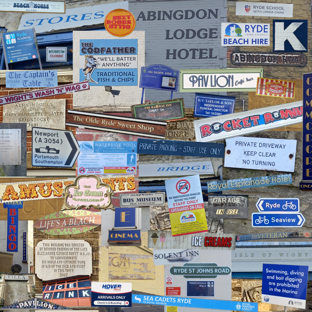
Updated photo collage.
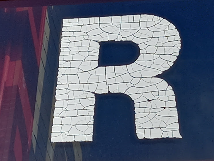
I just want to add this ‘R’ as these letters are beautiful, old, worn and peeling from the derelict ice rink, they are made from film/plastic stuck on the inside of glass. I like the way they have cracked over time creating texture that almost looks designed.
Having WiFi down for 48 hours gave me gave me a good play about with the photos. I put my photos in a repeat pattern and when zooming our notice a blue yellow colour theme, it looks like the ocean, as Ryde is the town on the beach this fits.
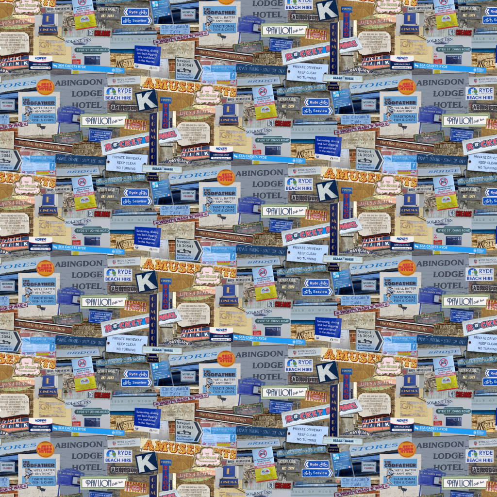
I decided the verticle cinema signs took away from the overall, so took them out which makes the pattern look more ocean.